
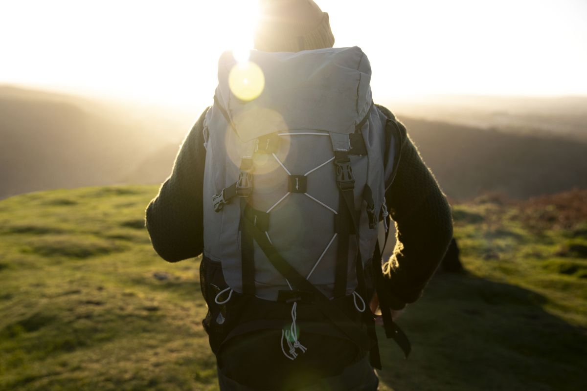
Szczyrk is a small town nestled in the Silesian Beskids, a part of the larger Western Carpathians. This area offers excellent conditions for skiing (both downhill and cross-country), mountain biking, and hiking, attracting outdoor enthusiasts year-round.
Is Szczyrk Part of the Beskids?
The Beskids is a collective name for mountain ranges that form part of the Carpathian Mountains. These mountains cover an area about 50-70 km wide and approximately 600 km long, stretching across Poland, Slovakia, Czechia, Ukraine, and Romania. The Beskids are divided into Western, Central, and Eastern Beskids. Szczyrk is located in the Silesian Voivodeship, in the valley of the Żylica River, between Bielsko-Biała, Żywiec, and Wisła. So, is Szczyrk part of the Beskids? Yes, the town is located in the Western Beskids, which include the Little Beskids, the Silesian Beskids, the Żywiec Beskids, and the Gorce.
What Mountain Range is in Szczyrk?
Szczyrk lies within the Silesian Beskids, which are divided into the Czantoria Range and the Wisła Range (also known as the Barania Góra Range). The Wisła Range includes the Barania Góra group, the Skrzyczne massif, and the Klimczok and Szyndzielnia group. The Silesian Beskids are bordered by the Żywiec Beskids to the southeast, the Moravian-Silesian Beskids to the west, and the Little Beskids to the northeast. The highest peak in the region is Skrzyczne (1,257 m), followed by Barania Góra (1,215 m) and Malinowska Skała (1,152 m).
Szczyrk – What Mountains Can Be Found Here?
Szczyrk is an ideal location for those who “collect” peaks that make up the Crown of Polish Mountains. From the town center, the green trail leads to Skrzyczne, the highest peak of the Silesian Beskids. However, this is not the only attraction for hiking and mountain biking enthusiasts visiting Szczyrk. What other mountains can you explore here?
Skrzyczne (1,257 m a.s.l.)
Skrzyczne is located in the northeastern part of the Silesian Beskids and is the fourth most prominent peak in the Polish Carpathians. The summit can be reached via the green trail from the town center or the yellow trail, which starts in Szczyrk Górny (take the yellow trail to Małe Skrzyczne, then follow the green trail to Skrzyczne). There is also a year-round cable car in Szczyrk that takes visitors to the top. The cable car is divided into two sections: Szczyrk – Jaworzyna and Jaworzyna – Skrzyczne. At the summit, in addition to the cable car station, there is a viewing terrace, a PTTK mountain shelter, and a radio transmitter tower with an operating building. Thanks to this distinctive RTV tower, Skrzyczne is easily recognizable from a distance, including from the Silesian Upland, located approximately 70 km away.
Malinowska Skała (1,152 m a.s.l.)
Now that we know which mountain range Szczyrk belongs to, let’s take a closer look at Malinowska Skała. This peak lies along the ridge connecting the two main peaks of the Silesian Beskids: Skrzyczne and Barania Góra. You can reach Malinowska Skała via the red trail from Salmopolska Pass, the blue trail from Szczyrk Solisko, or the green trail from Małe Skrzyczne. Malinowska Skała is composed of conglomerates, a multicolored sedimentary rock made of gravel bound by a natural cement. A few dozen meters from the peak, these conglomerates form a characteristic rocky outcrop, one of the most recognizable natural attractions of the Silesian Beskids. On the slopes of Malinowska Skała, you can also find a year-round pond and Malinka Cave.
Klimczok (1,117 m a.s.l.)
Still within the city of Szczyrk, what mountains offer the best views in the Silesian Beskids? One of the most scenic spots is Klimczok, which marks the boundary between Szczyrk and Bielsko-Biała. From here, you can enjoy panoramic views of the Żywiec Beskids, and on clear days, even Babia Góra and the Tatras. You can reach the summit via several trails, including the blue trail from the town center and the red trail from Karkoszczonka Pass.
Is it worth the effort to climb Klimczok? Absolutely! Here’s why:
- Many hikers consider it one of the most beautiful and scenic places in the Silesian Beskids.
- You can reach the summit on foot or by bike.
- There is a large PTTK mountain shelter near the summit, where you can rest and refuel.
- From Klimczok, you can also reach other attractions in the Silesian Beskids, such as Szyndzielnia (1,028 m a.s.l.), Trzy Kopce (1,082 m a.s.l.), or explore local caves like Piętrowa Cave and Cave in Trzy Kopce.
Magura (1,109 m a.s.l.)
What mountain range is in Szczyrk? To the south, there is the Skrzyczne and Barania Góra Range, while on the opposite side of the town lies the Klimczok and Szyndzielnia Range. It is in this second range that Magura is located, marking the boundary between Szczyrk and Bystra. You can reach the summit on the return journey from Klimczok or directly from Szczyrk – first via the blue trail on Turystyczna Street, then follow the black trail, and finally the yellow trail. Along the way, you can see the ruins of a stone pool built before World War II.
Trzy Kopce (1,082 m a.s.l.)
Trzy Kopce is a peak located about 750 m from Klimczok. You can reach it from Klimczok or from Karkoszczonka Pass. The peak forms the boundary between Szczyrk, Bielsko-Biała, and Brenna. During your hike, keep an eye out for the ruins of a mountain shelter. On the southern slopes, you’ll also find the entrance to Cave in Trzy Kopce, which stretches for 1,254 m, making it one of the longest caves in the Beskids.
Malinów (1,115 m a.s.l.)
Skrzyczne, Klimczok, and Malinowska Skała are the most well-known peaks in Szczyrk. What other mountains are worth exploring? One of them is Malinów, which, although relatively flat and forested, offers access to interesting attractions in the Silesian Beskids. From Malinów, you can take the red trail to Malinowska Skała. The hike is not too difficult, and along the way, you can admire interesting rock outcrops and views on both sides. Close to the trail is also Malinowska Cave, about 230 meters long.
Małe Skrzyczne (1,211 m a.s.l.) and Kopa Skrzyczeńska (1,189 m a.s.l.)
Hikers looking for a longer adventure can follow the trail from Skrzyczne to Malinowska Skała (or vice versa). Along the way, you’ll pass the flat elevation of Małe Skrzyczne. At the summit is a ski lift station, familiar to many skiers. On clear days, you can enjoy stunning views of distant peaks and take memorable photos. Nearby is also Kopa Skrzyczeńska (1,189 m a.s.l.), from which you can see Babia Góra, Pilsko, the Tatras, and even Praděd Peak in the Czech Republic.
Szczyrk – What Other Mountains Can Be Seen?
There is no doubt that Szczyrk is part of the Beskids. Skrzyczne, Malinowska Skała, Klimczok – these and other peaks clearly show why the Silesian Beskids are among the most beautiful mountain ranges in Poland. While hiking in Szczyrk, you can also explore lower peaks and scenic viewpoints.
From Salmopolska Pass, you can reach Kotarz (974 m), then continue through Beskidek (830 m) and arrive at Karkoszczonka Pass. From here, you can follow the blue trail to Błatnia (917 m). Alternatively, from Klimczok, take the yellow-red trail to Szyndzielnia (1,028 m). The trails are generally not technically difficult (though some may be physically demanding), so in Szczyrk, you are only limited by time and, possibly, the weather.
